


First agreements with the business
We have signed our first three cooperation agreements with surveying companies from Wrocław, Opole, and Poznań, Poland. Under these agreements, we will jointly test the PIGEON online positioning service in selected surveying work carried out by our partners.

Continuation of work thanks to funding from the FNP First Team FENG
Building on our experience in implementing the PIGEON service, by 2028 a comprehensive satellite deformation monitoring system will be developed, integrating GNSS and InSAR techniques. In 2027, we will present a prototype of a low-cost permanent GNSS station together with a remote management system at a high Technology Readiness Level (TRL).
Grzegorz Marut earns a doctorate in technical sciences.
On 30 October 2025, Grzegorz Marut defended his doctoral dissertation, titled “Potential and Limitations of Low-cost GNSS Receivers in Selected Geodetic Applications,” with distinction. It describes the characteristics of low-cost antennas and receivers, the development of a prototype of an inexpensive GNSS station, the algorithms, and the positioning results obtained using the new Galileo HAS service. Congratulations!
We detect deformations with low-cost receivers
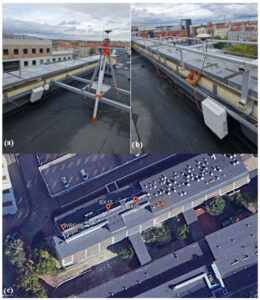
Field studies on simulated displacements prove that our algorithms effectively detect vertical displacements on the order of 20 mm (>99%) using a single station, in real time. More information can be found in the publication Maciejewska et al. 2024, “The Real-Time Detection of Vertical Displacements by Low-Cost GNSS Receivers Using Precise Point Positioning,” https://doi.org/10.3390/s24175599.

We’re testing the Galileo HAS service
Among the first in the world, we present the results of using Galileo’s High Accuracy Service in positioning, time transfer, and selected applications in the field of Earth sciences. We encourage you to read Hadaś et al. 2024, “Galileo High Accuracy Service in Real-Time PNT, Geoscience and Monitoring Applications”
Launch of the NCBR LIDER project
On 15 March 2023, work began on the PIGEON project, whose goal is to create a service for processing GNSS observations in real time. The final implementation of the PIGEON service will constitute a cloud-based Software as a Service (SaaS) computational service. The repeatability of the coordinates should be no worse than 2 cm.

The website was created as part of the project "Precise real-time GNSS positioning – an online service," financed by the National Centre for Research and Development under the LIDER XIII programme, agreement no. LIDER13/0075/2022 of 15 March 2023